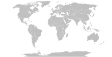
Berkas:BlankMap-World-Compact.svg

Ukuran pratayang PNG ini dari berkas SVG ini: 800 × 354 piksel Resolusi lainnya: 320 × 142 piksel | 640 × 284 piksel | 1.024 × 454 piksel | 1.280 × 567 piksel | 2.560 × 1.134 piksel.
Ukuran asli (Berkas SVG, secara nominal 2.560 × 1.134 piksel, besar berkas: 1,01 MB)
Riwayat berkas
Klik pada tanggal/waktu untuk melihat berkas ini pada saat tersebut.
| Tanggal/Waktu | Miniatur | Dimensi | Pengguna | Komentar | |
|---|---|---|---|---|---|
| 9 Juli 2011 17.18 |  | 940 × 415 (1,45 MB) | Smurfy | Added South Sudan with code "qx" as per BlankMap-World6.svg | |
| 24 Mei 2010 23.02 |  | 940 × 415 (1,45 MB) | Saftorangen | To match the original map: "Grey move : B9B9B9 to E0E0E0 according to wikipedia convention." See the file talk of BlankMap-World6.svg. | |
| 12 Oktober 2009 06.40 |  | 940 × 415 (1,45 MB) | Fibonacci | Same fixes as for the full map. | |
| 2 Desember 2008 18.21 |  | 940 × 415 (1,45 MB) | Lokal Profil | Reverted to version as of 14:51, 13 June 2008, new image has non of the complexity (i.e. colouring abilities etc.) of the old | |
| 2 Desember 2008 17.29 |  | 1.326 × 601 (172 KB) | Harbin | ||
| 2 Desember 2008 17.26 |  | 1.425 × 625 (185 KB) | Harbin | ||
| 13 Juni 2008 14.51 |  | 940 × 415 (1,45 MB) | Lokal Profil | Syncing with Image:BlankMap-World6.svg version (01:30, March 29, 2008). Sadly enough the validator does not seem to like rdf element of the metadata although it should work acording to http://www.w3schools.com/rdf/rdf_main.asp | |
| 8 Februari 2008 20.55 |  | 940 × 415 (1,46 MB) | CarolSpears | validated, maybe | |
| 14 Desember 2007 19.51 |  | 940 × 415 (1,46 MB) | Lokal Profil | Readded an ocean object but this one is square instead of the original elliptic one | |
| 14 Desember 2007 19.19 |  | 940 × 415 (1,46 MB) | Lokal Profil | {{Information |Description=Detailed SVG map with grouping enabled to connect all non-contiguous parts of a country's territory for easy colouring. Smaller countries can also be represented by larger circles to show their data easier. A thorough descriptio |
Penggunaan berkas
Tidak ada halaman yang menggunakan berkas ini.
Penggunaan berkas global
Wiki lain berikut menggunakan berkas ini:
- Penggunaan pada de.wiki-indonesia.club
- Penggunaan pada en.wiki-indonesia.club
- Penggunaan pada fr.wiki-indonesia.club
- Penggunaan pada zh.wiki-indonesia.club


