Berkas:Azerbaijan adm location map.svg

Ukuran asli (Berkas SVG, secara nominal 1.200 × 919 piksel, besar berkas: 274 KB)
Ringkasan
| Deskripsi |
Deutsch: Positionskarte von Aserbaidschan
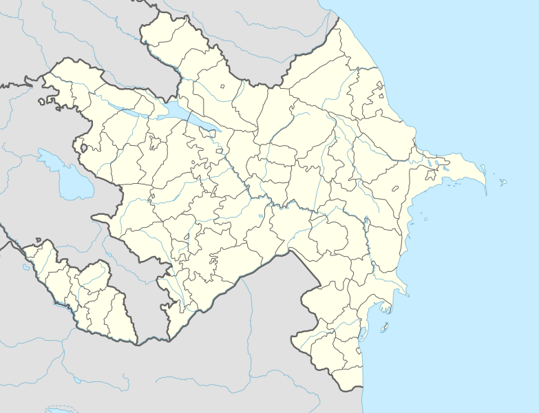
English: Location map of Azerbaijan
|
||||||||||||
| Tanggal | |||||||||||||
| Sumber |
Own work using:
|
||||||||||||
| Pembuat | NordNordWest | ||||||||||||
| Versi lainnya |
|
||||||||||||
_location_map.svg)
_location_map.svg)

|
This map has been made or improved in the German Kartenwerkstatt (Map Lab). You can propose maps to improve as well.
|
Lisensi
Usage of this file with:

explanatory notes: Legally binding is only the full legalcode. For a free usage I recommend to respect the following licence conditions:
1. Provide my name as given above: NordNordWest,
2. a copy of, or the URI for, the applicable license: https://creativecommons.org/licenses/by-sa/3.0/de/legalcode,
3. the title of the work,
4. in the case of an adaptation, a credit identifying the use of the work in the adaptation.
This license and the rights granted hereunder will terminate automatically upon any breach by you of the terms of this license. Any of the above conditions can be waived if you get permission from the copyright holder. If you have questions or wish differing conditions, please contact me through nnwest or my discussion page ![]() t-online.de
t-online.de
- Anda diizinkan:
- untuk berbagi – untuk menyalin, mendistribusikan dan memindahkan karya ini
- untuk menggubah – untuk mengadaptasi karya ini
- Berdasarkan ketentuan berikut:
- atribusi – Anda harus mencantumkan atribusi yang sesuai, memberikan pranala ke lisensi, dan memberi tahu bila ada perubahan. Anda dapat melakukannya melalui cara yang Anda inginkan, namun tidak menyatakan bahwa pemberi lisensi mendukung Anda atau penggunaan Anda.
- berbagi serupa – Apabila Anda menggubah, mengubah, atau membuat turunan dari materi ini, Anda harus menyebarluaskan kontribusi Anda di bawah lisensi yang sama seperti lisensi pada materi asli.

Riwayat berkas
Klik pada tanggal/waktu untuk melihat berkas ini pada saat tersebut.
| Tanggal/Waktu | Miniatur | Dimensi | Pengguna | Komentar | |
|---|---|---|---|---|---|
| 19 April 2021 15.53 |  | 1.200 × 919 (286 KB) | AntonSamuel | Minor border adjustments for Seysulan and area around Shusha | |
| 7 Maret 2021 15.13 |  | 1.200 × 919 (279 KB) | NordNordWest | c | |
| 10 Desember 2020 18.54 |  | 1.200 × 919 (277 KB) | NordNordWest | corr | |
| 24 November 2020 21.58 |  | 1.200 × 919 (276 KB) | NordNordWest | according to discussion page | |
| 17 November 2020 15.42 |  | 1.200 × 919 (281 KB) | BasilLeaf | Reverted to version as of 09:17, 17 November 2020 (UTC) | |
| 17 November 2020 15.38 |  | 1.200 × 919 (306 KB) | BasilLeaf | Reverted to version as of 07:54, 17 November 2020 (UTC). Fixing City of Shusha's status (www.azstat.org). Economic regions brought back, they're frequently shown on display maps in Azerbaijan, including on "www.azstat.org". | |
| 17 November 2020 09.17 |  | 1.200 × 919 (281 KB) | NordNordWest | Reverted to version as of 19:37, 16 November 2020 (UTC) | |
| 17 November 2020 07.54 |  | 1.200 × 919 (306 KB) | BasilLeaf | Jabrayil district fix, was in the wrong Region | |
| 17 November 2020 06.47 |  | 1.200 × 919 (308 KB) | BasilLeaf | Broken file. Minor update. Shusha city is a part of Shusha Rayon, as per https://www.azstat.org/webmap/?lang=en Economic Regions added to the map as well. | |
| 17 November 2020 06.45 |  | 1.200 × 919 (299 KB) | BasilLeaf | Minor update. Shusha city is a part of Shusha Rayon, as per https://www.azstat.org/webmap/?lang=en Economic Regions added to the map as well. |
Penggunaan berkas
93 halaman berikut menggunakan berkas ini:
- Abad, Azerbaijan
- Abdınlı
- Acarlı
- Afurca
- Agalarbeyli
- Agdam
- Agdash, Azerbaijan
- Aghjabadi (kota)
- Alıc
- Amsarqışlaq
- Ashagy Kharasha
- Atuc
- Ayaq Qərvənd
- Aydınkənd
- Azykh
- Ağalarbəyli
- Ağbil
- Ağcaqovaq
- Aşağı Atuc
- Aşağı Ağcayazı
- Aşağı Güzdək
- Aşağı Tüləkəran
- Aşağı Xuç
- Babı
- Bandar Udara Belokany
- Bandar Udara Internasional Fuzuli
- Bandar Udara Internasional Ganja
- Bandar Udara Internasional Heydar Aliyev
- Bandar Udara Internasional Lachin
- Bandar Udara Internasional Lankaran
- Bandar Udara Internasional Zangilan
- Bandar Udara Internasional Zaqatala
- Bandar Udara Nakhchivan
- Bandar Udara Qabala
- Barlı
- Bağçalı
- Birinci Nügədi
- Buduq
- Bərğov
- Cimi
- Daftar Situs Warisan Dunia di Azerbaijan
- Daftar Situs Warisan Dunia di Eropa
- Daftar klub sepak bola divisi tertinggi di negara anggota UEFA
- Dalıqaya
- Dağüstü
- Dərk
- Fırıq
- Gilyanov
- Gömürdəhnə
- Gültəpə
- Güləzi
- Gürdəh
- Gədik
- Gədikqışlaq
- Gədəbəy
- Gəray
- Hacıhüseynli
- Hacıqaib
- Haput
- Ismailli
- Kalbajar
- Karakyz
- Kardash
- Kazmabudug
- Khinalug
- Kunxırt
- Köhnəqışlaq, Agstafa
- Küçeyi
- Pembangkit Listrik Tenaga Air Mingachevir
- Qırmızı Qəsəbə
- Sepak bola pada Pesta Olahraga Solidaritas Islam 2017
- Stepanakert
- Sulut
- Tərtər
- Yardımlı
- Zaqatala (kota)
- Çartəpə
- Çarxaçu
- Çayqışlaq
- Çiçi
- Çiçəkli, Gədəbəy
- Çənlibel
- İbrahimhapıt
- İdrisqışlaq
- İkinci Nügədi
- İqrığ
- İspik
- Əlibəyqışlaq
- Əlik
- Ərməki
- Əski İqrığ
- Əspərəsti
- Templat:Location map Azerbaijan
Penggunaan berkas global
Wiki lain berikut menggunakan berkas ini:
- Penggunaan pada ab.wiki-indonesia.club
- Penggunaan pada af.wiki-indonesia.club
- Penggunaan pada als.wiki-indonesia.club
- Penggunaan pada ang.wiki-indonesia.club
- Penggunaan pada an.wiki-indonesia.club
- Penggunaan pada ar.wiki-indonesia.club
- Penggunaan pada ast.wiki-indonesia.club
- Baku Crystal Hall
- Bakú
- Estadiu Tofiq Bəhramov
- Complexu Deportivu y de Conciertos Heydər Əliyev
- Tigranakert (Artsakh)
- Stepanakert
- Sumqayit
- Mingachevir
- Circuitu urbanu de Bakú
- Módulu:Mapa de llocalización/datos/Azerbaixán
- Módulu:Mapa de llocalización/datos/Azerbaixán/usu
- Frontera ente Azerbaixán ya Irán
- Frontera ente Azerbaixán y Turquía
- Alministración Presidencial d'Azerbaixán
- Aeropuertu Internacional Heydar Aliyev
- Aeropuertu de Ganja
- Aeropuertu de Stepanakert
- Puertu comercial marítimu internacional de Bakú
- Muséu Estatal d'Historia d'Azerbaixán
- Muséu d'Arte Modernu de Bakú
- Observatoriu Astrofísicu de Şamaxı
- Metro de Bakú
- Estación de ferrocarril de Bakú
- Islla Gil (Azerbaixán)
- Penggunaan pada av.wiki-indonesia.club
- Penggunaan pada azb.wiki-indonesia.club
Lihat lebih banyak penggunaan global dari berkas ini.