County El Dorado, California
El Dorado County (/ l dəˈrɑːdoʊ/ (suara ikon pendengar)), secara resmi County of El Dorado, adalah sebuah county di negara bagian California, AS. Pada sensus 2020, populasinya adalah 191.185.[3] Kursi county adalah Placerville.
El Dorado County, California | ||||||
|---|---|---|---|---|---|---|
| County of El Dorado | ||||||
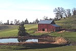
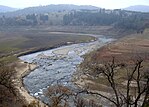
Images, from top down, left to right: A barn in El Dorado County, the shore of Lake Tahoe in Ed Z'berg Sugar Pine Point State Park, the South Fork American River running through the El Dorado hills, Marshall Gold Discovery State Historic Park | ||||||
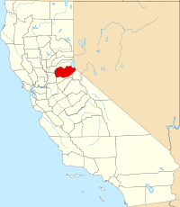
 Interactive map of El Dorado County | ||||||
 Location in the state of California | ||||||
| Country | United States | |||||
| State | California | |||||
| Regions | Northern California, Sierra Nevada, Gold Country | |||||
| Metropolitan area | Greater Sacramento | |||||
| Incorporated | February 18, 1850[1] | |||||
| Dinamai berdasarkan | Spanish for "the golden" and El Dorado | |||||
| County seat | Placerville | |||||
| Largest city | El Dorado Hills | |||||
| Luas | ||||||
| • Total | 1.786 sq mi (4,630 km2) | |||||
| • Luas daratan | 1.708 sq mi (4,420 km2) | |||||
| • Luas perairan | 78 sq mi (200 km2) | |||||
| Ketinggian tertinggi | 10.886 ft (3,318 m) | |||||
| Populasi (2020) | ||||||
| • Total | 191.185 | |||||
| • Kepadatan | 110/sq mi (41/km2) | |||||
| Zona waktu | UTC−8 (Pacific Time Zone) | |||||
| • Musim panas (DST) | UTC−7 (Pacific Daylight Time) | |||||
| ZIP code | 95762 | |||||
| Kode area telepon | 530, 916, 279 | |||||
| FIPS code | 06-017 | |||||
| GNIS feature ID | 277273 | |||||
| Situs web | www.edcgov.us | |||||
Referensi
- ^ "Chronology". California State Association of Counties. Diakses tanggal February 6, 2015.
- ^ "Freel Peak". Peakbagger.com. Diakses tanggal February 6, 2015.
Pranala luar
Wikimedia Commons memiliki media yang terkait dengan:
- Situs web resmi
- El Dorado County Deeds, 1873-1930.
- official El Dorado County Historical Museum website
- El Dorado Environmental air quality management - naturally occurring asbestos information
- El Dorado County Weather
- El Dorado County Visitors Authority
- Sierra Community Access Television
- El Dorado Western Railway Foundation blog - The railway is restoring the Diamond & Caldor No. 4 Shay locomotive at the El Dorado County Historical Museum.
Templat:Cities of El Dorado County, California Templat:Greater Sacramento


