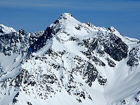
Piz Calderas
gunung di Swiss
| Piz Calderas | |
|---|---|
 View from the south-west | |
| Titik tertinggi | |
| Ketinggian | 3.397 m (11.145 ft) |
| Puncak | 1.085 m (3.560 ft)[1] |
| Isolasi | 165 km (103 mi)[2] |
| Puncak induk | Piz Kesch |
| Masuk dalam daftar | Alpine mountains above 3000 m |
| Koordinat | 46°32′11.1″N 09°41′45.6″E / 46.536417°N 9.696000°E |
| Geografi | |
| Letak | Graubünden, Switzerland |
| Pegunungan | Albula Alps |
Lihat juga
Referensi
Tautan eksternal
- ^ Retrieved from the Swisstopo topographic maps. The key col is the Albula Pass (2,312 m).
- ^ Retrieved from Google Earth. The nearest point of higher elevation is west of Piz Kesch.
