County Alameda, California
county di California, Amerika Serikat
(Dialihkan dari Alameda County, California)
Alameda County adalah county yang terletak di negara bagian California, Amerika Serikat. Jumlah penduduk berdasarkan estimasi tahun 2008 sebesar 1.474.368 jiwa.
Alameda County | |
|---|---|
County | |
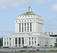
 Pengadilan Tinggi Alameda County di Oakland | |
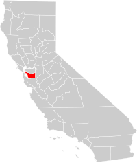
 Lokasi di California | |
 Lokasi California di Amerika Serikat | |
| Negara | Amerika Serikat |
| Negara Bagian | California |
| Region/Metro area | San Francisco Bay Area |
| Incorporated | 25 Maret 1853 |
| Ibukota County | Oakland |
| Kota terbesar | Oakland |
| Luas | |
| • Total | 821 sq mi (2,130 km2) |
| • Luas daratan | 737 sq mi (1,910 km2) |
| • Luas perairan | 83 sq mi (210 km2) |
| Populasi (estimasi 2008) | 1.474.368 |
| • Kepadatan | 1.795/sq mi (693/km2) |
| Zona waktu | UTC-8 (Waktu Standar Pasifik) |
| • Musim panas (DST) | UTC-7 (Waktu Standar Pasifik) |
| Kode area telepon | 510, 925 |
| Situs web | www.acgov.org |
Kota
sunting- Alameda
- Albany
- Berkeley
- Dublin
- Emeryville
- Fremont
- Hayward
- Livermore
- Newark
- Oakland
- Piedmont
- Pleasanton
- San Leandro
- Union City
Communities
suntingCities
suntingCensus-designated places
suntingUnincorporated communities
suntingFormer townships
sunting- Oakland Township – the northern portion subsequently became the cities of Berkeley and Albany.
- Alameda Township – now essentially coterminous with the City of Alameda.
- Brooklyn Township – mostly contained within Oakland and Piedmont.
- Eden Township – partly incorporated into San Leandro and Hayward, the rest contains the communities of Castro Valley, San Lorenzo, and other unincorporated areas.
- Washington Township – contains Union City, Newark, Fremont, and small unincorporated areas nearby.
- Murray Township
Jalan utama
sunting- Interstate 80 (Eastshore Freeway)
- Interstate 238
- Interstate 580 (MacArthur Freeway/Arthur Breed Freeway)
- Interstate 680 (Sinclair Freeway)
- Interstate 880 (Nimitz Freeway/Cypress Freeway)
- Interstate 980 (John B. Williams Freeway)
- State Route 13 (Warren Freeway/Tunnel Road/Ashby Avenue)
- State Route 24 (William Byron Rumford Freeway)
- State Route 61
- State Route 84
- State Route 92 (Jackson Street/San Mateo Bridge)
- State Route 123 (San Pablo Avenue) – formerly U.S. Route 40
- State Route 185 (Mission Boulevard/East 14th Street)
- State Route 238 (Mission Boulevard/Foothill Boulevard)
- State Route 262 (Mission Boulevard)
Pranala luar
sunting- Alameda County's Official Web Site
- Alameda County's VA Loan Center
- [1] map of Alameda County with supervisorial district boundaries
- Alameda County Fairgrounds - Annual county fair June to July
- A short film about Alameda County from 1958
- Short radio episode Baseball Diarsipkan 2012-10-28 di Wayback Machine. from "Lil' Yokohama," by Oakland writer Toshio Mori, 1941. California Legacy Project.
- Alameda County Fire Department Diarsipkan 2016-03-29 di Wayback Machine.
- Alameda County Fire Department Training Division Diarsipkan 2017-09-11 di Wayback Machine.
- Hiking trails in Alameda County, at the Berkeley Wiki website