Berkas:Antarctica map.jpg
Ukuran asli (4.549 × 3.973 piksel, ukuran berkas: 6,18 MB, tipe MIME: image/jpeg)
| Peringatan | Berkas asli ini diunggah dalam resolusi paling tinggi. Media ini mungkin tidak dapat dimuat dengan baik atau dapat menyebabkan peramban web Anda menjadi tidak responsif saat membukanya. Gunakan ZoomViewer untuk mengatasi masalah ini. |
|---|
| Penerbit |
Justus Perthes |
||||
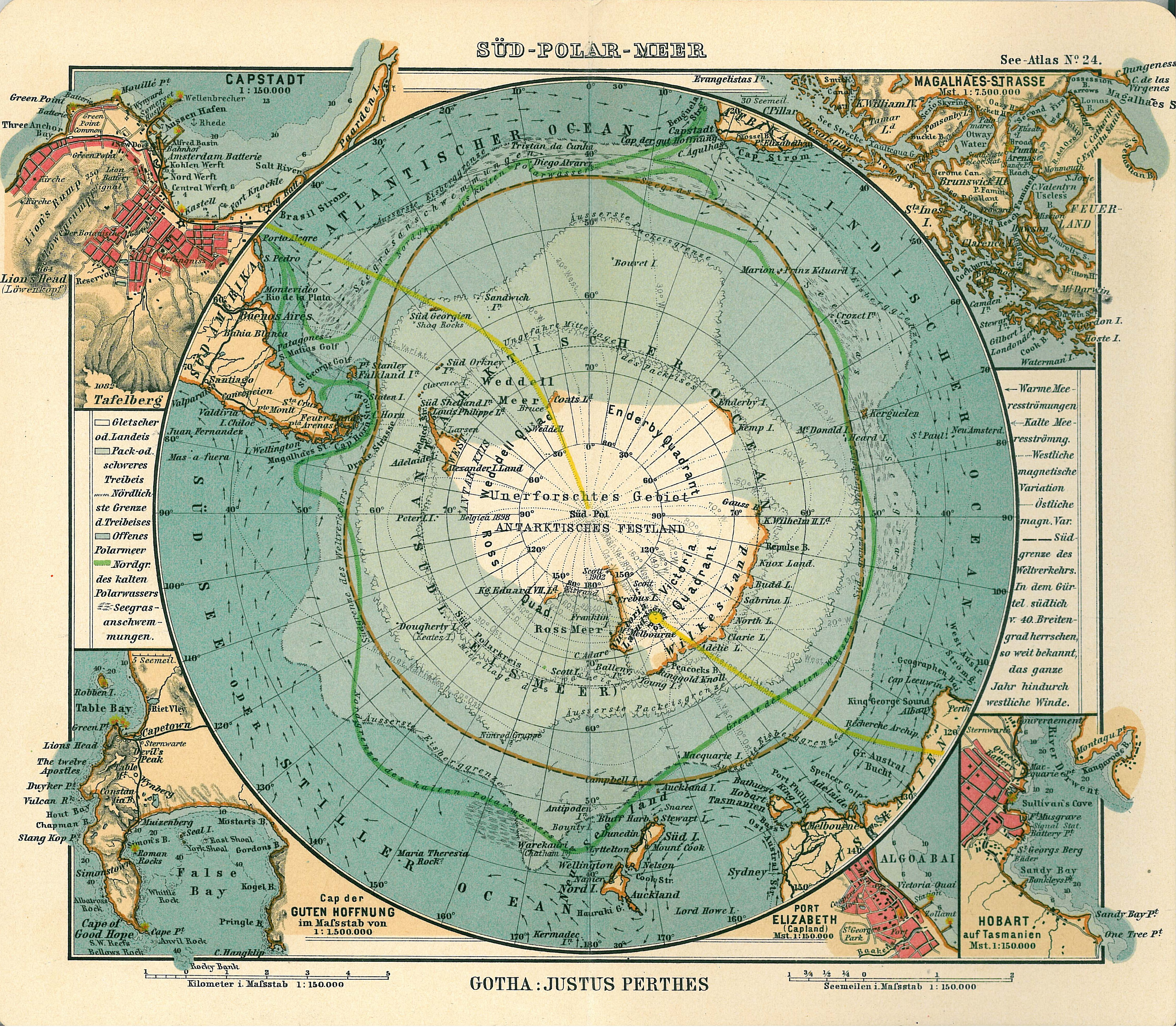
| Deskripsi |
Deutsch: Blatt 24, Süd-Polar-Meer
English: Page 24, Antarctica, Inset maps of Cape town, Cape of good hope, Magalhaes strait, Hobart, Port Elizabeth |
||||
| Tanggal terbit | 1906 | ||||
| Tempat penerbitan | Gotha | ||||
| Sumber | See Atlas | ||||
| Izin (Menggunakan kembali berkas ini) |
|
||||
.jpg)
Riwayat berkas
Klik pada tanggal/waktu untuk melihat berkas ini pada saat tersebut.
| Tanggal/Waktu | Miniatur | Dimensi | Pengguna | Komentar | |
|---|---|---|---|---|---|
| terkini | 15 Januari 2007 17.08 | | 4.549 × 3.973 (6,18 MB) | Martas011 | Category:Old maps of Antarctica Category:Maps of oceans Category:Maps of the Southern Ocean Good map of Antarctica, Justhus Perthes See Atlas 1906 Inset maps of Cape town, Cape of good hope, Magalhaes strait, Hobart, Port Elizabeth |
Penggunaan berkas
2 halaman berikut menggunakan berkas ini:
Penggunaan berkas global
Wiki lain berikut menggunakan berkas ini:
- Penggunaan pada avk.wiki-indonesia.club
- Penggunaan pada ca.wiki-indonesia.club
- Penggunaan pada de.wiki-indonesia.club
- Penggunaan pada en.wiki-indonesia.club
- Penggunaan pada eo.wiki-indonesia.club
- Penggunaan pada it.wiki-indonesia.club
- Penggunaan pada ja.wiki-indonesia.club
- Penggunaan pada nl.wiki-indonesia.club
- Penggunaan pada pl.wiki-indonesia.club
- Penggunaan pada pt.wiki-indonesia.club
- Penggunaan pada ru.wiki-indonesia.club
- Penggunaan pada zh.wiki-indonesia.club