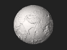
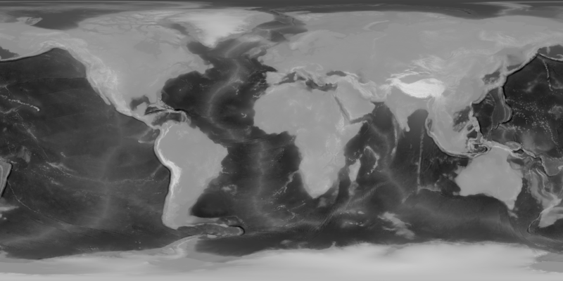
Berkas:Earth dry elevation.png

Ukuran pratayang ini: 800 × 400 piksel. Resolusi lainnya: 320 × 160 piksel | 640 × 320 piksel | 1.024 × 512 piksel | 1.280 × 640 piksel | 2.160 × 1.080 piksel.
Ukuran asli (2.160 × 1.080 piksel, ukuran berkas: 827 KB, tipe MIME: image/png)
Ringkasan
| Deskripsi |
English: Equirectangular depthmap of Earth combining topography and bathymetry from NASA Visible Earth to generate File:Earth_dry_elevation.stl |
|
| Tanggal | ||
| Sumber | http://visibleearth.nasa.gov/view.php?id=73934 (topography) and http://visibleearth.nasa.gov/view.php?id=73963 (bathymetry) | |
| Pembuat | NASA Visible Earth and cmglee | |
| Versi lainnya |
|
Lisensi
| Berkas ini berada dalam domain publik di Amerika Serikat karena semata-mata diciptakan oleh NASA. Kebijakan hak cipta NASA menyatakan bahwa "materi NASA tidak dilindungi oleh hak cipta kecuali dicatat". (Lihat Template:PD-USGov, Halaman kebijakan hak cipta NASA atau JPL Image Use Policy.) | ||
 |
Peringatan:
|
Riwayat berkas
Klik pada tanggal/waktu untuk melihat berkas ini pada saat tersebut.
| Tanggal/Waktu | Miniatur | Dimensi | Pengguna | Komentar | |
|---|---|---|---|---|---|
| terkini | 1 April 2021 19.12 | | 2.160 × 1.080 (827 KB) | Cmglee | Uploaded a work by NASA Visible Earth and cmglee from http://visibleearth.nasa.gov/view.php?id=73934 (topography) and http://visibleearth.nasa.gov/view.php?id=73963 (bathymetry) with UploadWizard |
Penggunaan berkas
Halaman berikut menggunakan berkas ini: