Berkas:Krt 1510 full.jpg

Ukuran asli (4.000 × 3.000 piksel, ukuran berkas: 14,13 MB, tipe MIME: image/jpeg)
Ringkasan
| Deskripsi |
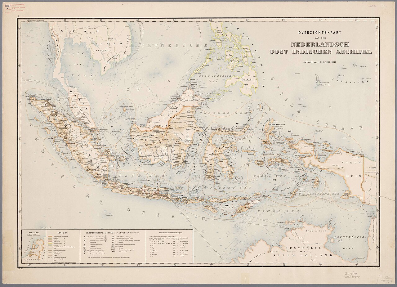
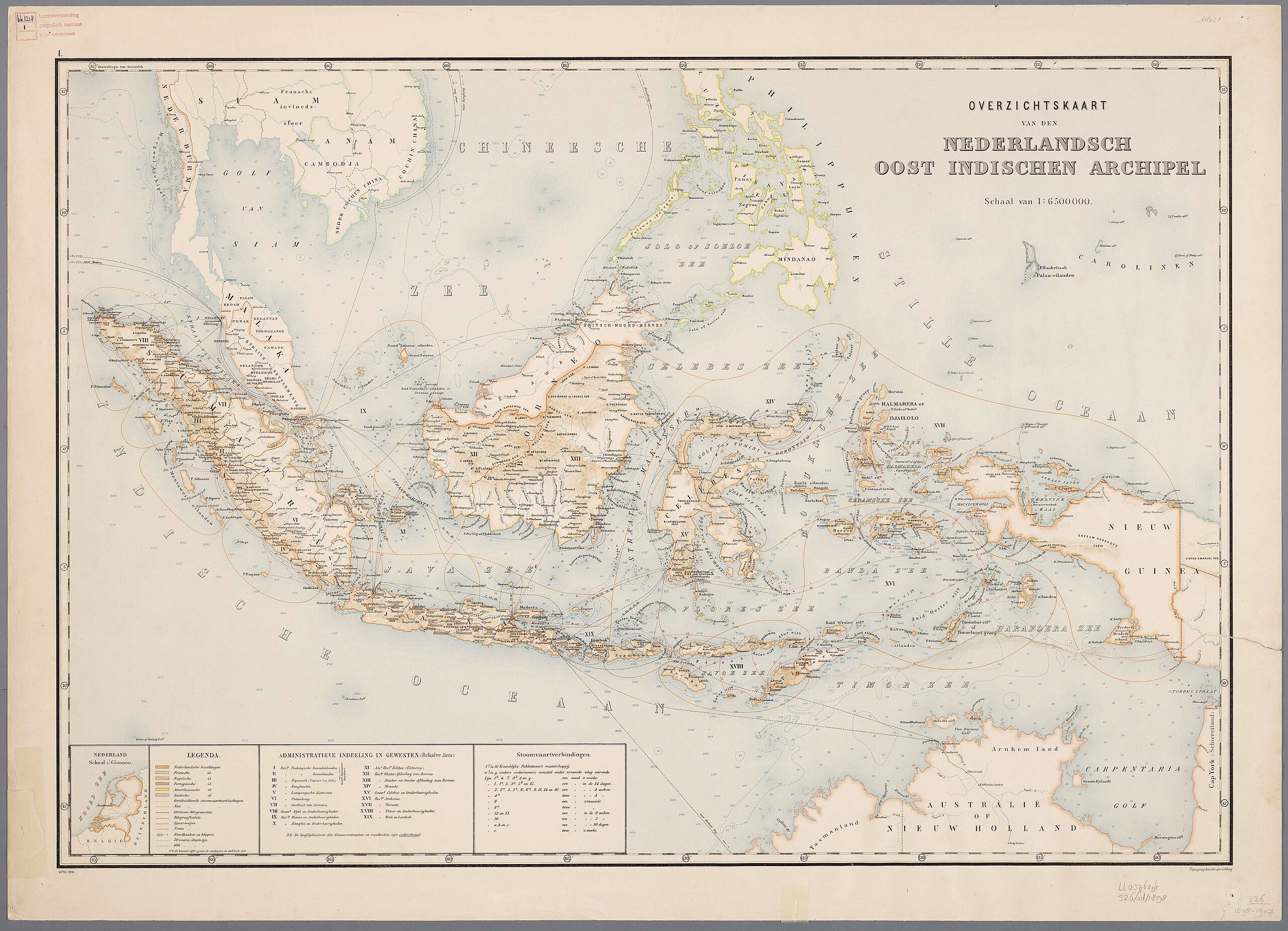
Nederlands: Atlas van Nederlandsch Oost-Indië / samengest. door Topographisch Bureau te Batavia van 1897-1904 |
| Tanggal | 1897-1904 |
| Sumber |
https://vu.contentdm.oclc.org/digital/collection/krt/id/1510 or https://digitalcollections.universiteitleiden.nl/view/item/2014658 restored and enchanced by u/helloVizart |
| Pembuat | Topographisch Bureau, Batavia |
| Versi lainnya |
.jpg)
.jpg)


|
This work is in the public domain in its country of origin and other countries and areas where the copyright term is the author's life plus 70 years or fewer.
| |
| Berkas ini telah diidentifikasi bebas dari pembatasan menurut hukum hak cipta termasuk semua hak terkait dan relevan. | |
Riwayat berkas
Klik pada tanggal/waktu untuk melihat berkas ini pada saat tersebut.
| Tanggal/Waktu | Miniatur | Dimensi | Pengguna | Komentar | |
|---|---|---|---|---|---|
| terkini | 8 Agustus 2023 06.44 | | 4.000 × 3.000 (14,13 MB) | Bennylin | restored and enchanced by u/helloVizart |
| 8 Agustus 2023 06.41 |  | 4.555 × 3.292 (1,81 MB) | Bennylin | {{Information |Description={{nl|Atlas van Nederlandsch Oost-Indië / samengest. door Topographisch Bureau te Batavia van 1897-1904<br /> 1. Overzichtskaart van den Nederlandsch Oost Indischen Archipel}} |Source=https://vu.contentdm.oclc.org/digital/collection/krt/id/1510 |Date=1897-1904 |Author=Topographisch Bureau, Batavia |Permission= |other_versions= }} {{PD-old}} Category:Old maps of Indonesia |
Penggunaan berkas
Tidak ada halaman yang menggunakan berkas ini.
Penggunaan berkas global
Wiki lain berikut menggunakan berkas ini: