Berkas:Political map of the Ausgleich.jpg

Ukuran pratayang ini: 763 × 600 piksel. Resolusi lainnya: 306 × 240 piksel | 611 × 480 piksel | 978 × 768 piksel | 1.280 × 1.006 piksel | 1.582 × 1.243 piksel.
Ukuran asli (1.582 × 1.243 piksel, ukuran berkas: 360 KB, tipe MIME: image/jpeg)
Ringkasan
| Deskripsi |
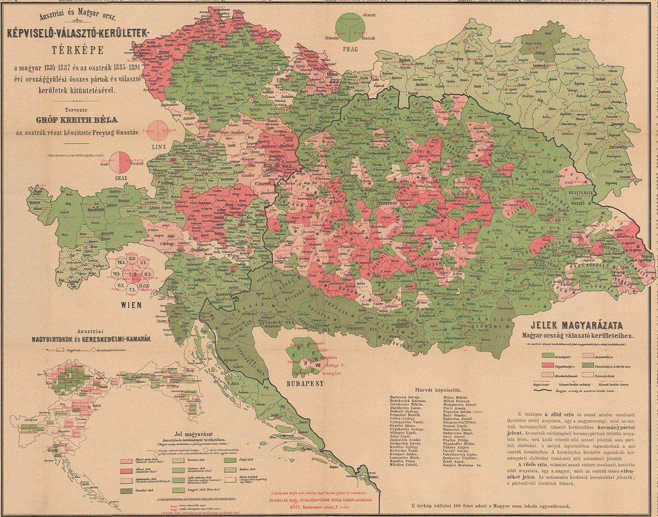
English: Political map of the Ausgleich. Electoral districts with majority of the A-H compromise supporter parties are in green. Electoral districts with majority against the A-H compromise are in red/purple. The map is based on the Austrian general elections between 1885-1889, and the Hungarian parliamentary elections between 1884-1887. |
| Tanggal | |
| Sumber | https://m.blog.hu/pa/pangea/image/monarchia.jpg |
| Pembuat | Count Béla Kreith and Gustav Freytag |
Lisensi
|
This work is in the public domain in its country of origin and other countries and areas where the copyright term is the author's life plus 70 years or fewer. Karya ini berada dalam domain publik di Amerika Serikat karena karya ini dipublikasikan (atau didaftarkan di U.S. Copyright Office) sebelum 1 Januari 1929. | |
| Berkas ini telah diidentifikasi bebas dari pembatasan menurut hukum hak cipta termasuk semua hak terkait dan relevan. | |
Riwayat berkas
Klik pada tanggal/waktu untuk melihat berkas ini pada saat tersebut.
| Tanggal/Waktu | Miniatur | Dimensi | Pengguna | Komentar | |
|---|---|---|---|---|---|
| terkini | 12 Juni 2019 13.52 | | 1.582 × 1.243 (360 KB) | Draguler | User created page with UploadWizard |
Penggunaan berkas
Halaman berikut menggunakan berkas ini:
Penggunaan berkas global
Wiki lain berikut menggunakan berkas ini:
- Penggunaan pada en.wiki-indonesia.club
- Penggunaan pada vi.wiki-indonesia.club