Berkas:Vallard map rotated.jpg
Vallard_map_rotated.jpg (795 × 599 piksel, ukuran berkas: 149 KB, tipe MIME: image/jpeg)

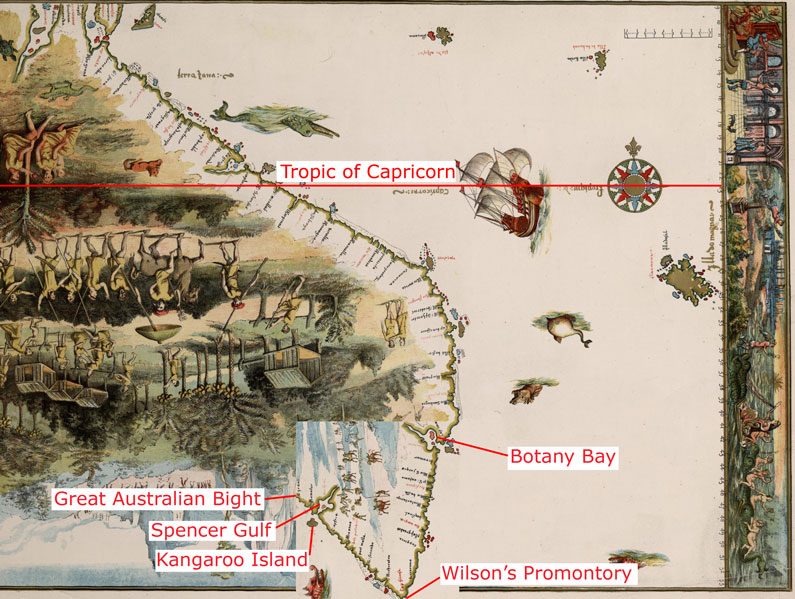
The 1542 Vallard map, with part of the bottom area rotated at 90 degrees, in the same way as described as done by journalist Peter Trickett [1] The image labelled with the claimed modern day locations shown on the map.
It should be noted that the latitude this would give for Wilson's Promontory using the scale visible on the right hand side of the map is 54°S (see: 54°S 145°E / 54°S 145°E) which is far to the south of Tasmania; when Wilson's Promontory is only at 39°S (39°02′S 146°23′E / 39.033°S 146.383°E). The claimed Botany Bay also appears at 43°S which is as far south as Hobart (see: 43°S 147°E / 43°S 147°E), when it is actually only at 33°S (33°58′S 151°10′E / 33.967°S 151.17°E)
|
This work is in the public domain in its country of origin and other countries and areas where the copyright term is the author's life plus 70 years or fewer. | |
| Berkas ini telah diidentifikasi bebas dari pembatasan menurut hukum hak cipta termasuk semua hak terkait dan relevan. | |
Riwayat berkas
Klik pada tanggal/waktu untuk melihat berkas ini pada saat tersebut.
| Tanggal/Waktu | Miniatur | Dimensi | Pengguna | Komentar | |
|---|---|---|---|---|---|
| terkini | 23 Maret 2007 08.59 | | 795 × 599 (149 KB) | Roke~commonswiki | The 1542 Vallard map, with part of the bottom area rotated at 90 degrees, in the same way as described as done by journalist Peter Trickett [http://www.smh.com.au/news/national/rotated-map-puts-a-twist-in-the-foundation- |
Penggunaan berkas
Halaman berikut menggunakan berkas ini:
Penggunaan berkas global
Wiki lain berikut menggunakan berkas ini:
- Penggunaan pada en.wiki-indonesia.club
- Penggunaan pada fr.wiki-indonesia.club
- Penggunaan pada it.wiki-indonesia.club