Les Alluets-le-Roi
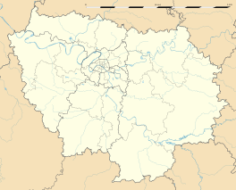
Les Alluets-le-Roi merupakan sebuah komune di departemen Yvelines yang terletak pada sebelah utara pusat Prancis.
Les Alluets-le-Roi | |
|---|---|
 Balai kota | |
| Koordinat: 48°54′54″N 1°55′12″E / 48.915000°N 01.92°E | |
| Negara | Prancis |
| Region | Île-de-France |
| Departemen | Yvelines |
| Arondisemen | Saint-Germain-en-Laye |
| Kanton | Poissy-Sud |
| Pemerintahan | |
| • Wali kota (2008–2014) | Daniel Gorbaty |
| Luas | |
| • Land1 | 7,39 km2 (285 sq mi) |
| • Populasi2 | 1.194 |
| • Kepadatan Populasi2 | 1,6/km2 (4,2/sq mi) |
| Kode INSEE/pos | 78010 / 78580 |
| Ketinggian | 150–187 m (492–614 ft) (rerata 180 m or 590 ft) |
| 1 Data Pendaftaran Tanah Prancis, tak termasuk danau, kolam, gletser > 1 km² (0.386 mi² atau 247 ekar) dan muara sungai. 2 Population sans doubles comptes: penghitungan tunggal penduduk di komune lain (e.g. mahasiswa dan personil militer). | |
Populasi
sunting| Populasi historis | ||
|---|---|---|
| Tahun | Jumlah Pend. | ±% |
| 1793 | 453 | — |
| 1800 | 425 | −6.2% |
| 1806 | 479 | +12.7% |
| 1821 | 533 | +11.3% |
| 1831 | 541 | +1.5% |
| 1836 | 550 | +1.7% |
| 1841 | 552 | +0.4% |
| 1846 | 520 | −5.8% |
| 1851 | 523 | +0.6% |
| 1856 | 475 | −9.2% |
| 1861 | 441 | −7.2% |
| 1866 | 453 | +2.7% |
| 1872 | 442 | −2.4% |
| 1876 | 448 | +1.4% |
| 1881 | 447 | −0.2% |
| 1886 | 468 | +4.7% |
| 1891 | 470 | +0.4% |
| 1896 | 434 | −7.7% |
| 1901 | 383 | −11.8% |
| 1906 | 395 | +3.1% |
| 1911 | 381 | −3.5% |
| 1921 | 347 | −8.9% |
| 1926 | 393 | +13.3% |
| 1931 | 370 | −5.9% |
| 1936 | 379 | +2.4% |
| 1946 | 319 | −15.8% |
| 1954 | 396 | +24.1% |
| 1962 | 393 | −0.8% |
| 1968 | 483 | +22.9% |
| 1975 | 632 | +30.8% |
| 1982 | 826 | +30.7% |
| 1990 | 1.062 | +28.6% |
| 1999 | 1.266 | +19.2% |
| 2008 | 1.194 | −5.7% |
Lihat juga
suntingReferensi
sunting


