Moortown
53°50′40″N 1°32′02″W / 53.8445°N 1.5339°W
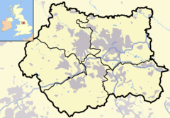
Moortown adalah daerah suburban di pinggiran kota Leeds, West Yorkshire, Inggris di daerah kode pos LS17. Daerah ini adalah paroki sipil dan dapil pemilu di utara kota. Wilayah ini terletak antara Roundhay dan Brackenwood di sebelah timur dan Weetwood di sebelah barat, dengan Chapel Allerton di selatan, dan Alwoodley di utara. Daerah ini pada dasarnya mirip dengan Moor Allerton,[1][2] dan institusi di daerah ini menggunakan salah satu dari dua nama tersebut.[3][4]
Referensi
sunting- ^ Ralph Thoresby (1715) Ducatus Leodiensis: or, the topography of the ancient and populous town and parish of Leedes,and parts adjacent in the West Riding of York, page 135
- ^ A History of Leeds, compiled from various authors (1797) (Leeds) page 57
- ^ The Ordnance Survey gives the name Moor Allerton to the southeasternmost part (where Moor Allerton School is), whereas the Moor Allerton shopping Centre, containing Moor Allerton Library, is to the west by the junction of King Lane and the Ring Road (A6120). This is actually on the site of the original village of Moore Allerton.
- ^ Seperti Chapeltown dan Chapel Allerton
Pranala luar
sunting- YEP Moortown Today Community Website
- Moortown Corner House 2003, Leodis Photographic Archive
- Moortown Corner 1950, with tram tracks along Street Lane, Leodis Photographic Archive
- Moortown Plantation, Forest of Leeds
