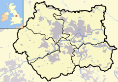
Roundhay
53°49′52″N 1°29′49″W / 53.831000°N 1.497000°W
| Roundhay | |
 Canal Gardens, Taman Roundhay |
|
| Population | 21.823 |
|---|---|
| Ref. grid OS | SE331373 |
| Distrik metropolitan | Kota Leeds |
| County metropolitan | West Yorkshire |
| Region | Yorkshire and the Humber |
| Negara konstituen | Inggris |
| Negara berdaulat | Britania Raya |
| Kota pos | LEEDS |
| Distrik kode pos | LS8 |
| Kode telepon | 0113 |
| Polisi | West Yorkshire |
| Pemadam kebakaran | West Yorkshire |
| Ambulans | Yorkshire |
| Parlemen UE | Yorkshire and the Humber |
| Parlemen Britania Raya | Leeds Timur Laut |
| Daftar tempat: Britania Raya • Inggris • Yorkshire | |
Roundhay adalah sebuah Distrik Dewan Kota dari Leeds, West Yorkshire, Inggris yang luas dan dipandang makmur, di sisi timur laut kota, terutama yang termasuk oleh kode pos LS8. Perbatasan Distrik Kota Metropolitan ditandai oleh jalan lingkar A6120 di utara dan jalan Wetherby A58 di selatan dan barat. Jalanan ini menelusuri Jalan Lembah Gledhow ke barat sebelum mengarah ke timur laut ke A6120.[1] Oleh karena itu wilayah dari daerah ini meliputi wilayah kecil dari Gledhow dan Oakwood, yang sering dianggap sebagai wilayah suburban yang berbeda. Distrik kota yang bersinggungan langsung adalah Alwoodley dan Harewood di utara, Moortown di barat, Chapel Allerton ke barat daya, Gipton dan Harehills di selatan, ditambah Killingbeck dan Seacroft ke tenggara. Di perbatasan timur laut adalah Shadwell, bagian dari Distrik Kota Crossgates dan Whinmoor.
Referensi
suntingPranala luar
sunting- YEP Roundhay Today Community Website
- The Friends of Roundhay Park - Registered Charity
- The Roundhegians Diarsipkan 2006-12-31 di Archive.is
- Images of Roundhay Diarsipkan 2007-10-21 di Wayback Machine.
- All Nations Community Church
- history of Roundhay Park Conservation Area Diarsipkan 2007-10-12 di Wayback Machine.
- The Ancient Parish of Barwick in Elmet at GENUKI: Roundhay was in this parish
